Uzbekistan is creating broad opportunities for young people. In particular, Uzbek girls are showing an increasing desire to gain knowledge and a strong sense of responsibility for self-development. They are not only mastering modern sciences but are also preserving national values while earning a достойный place in society.
Knowledge and education have always held an important position in the national values of the Uzbek people. Since ancient times, special attention has been given to ensuring that girls are not only well-mannered but also well-educated. This tradition continues to maintain its significance today.
Nowadays, educational opportunities are expanding even further. Girls actively participate in schools and higher educational institutions, achieving remarkable success in various fields. Many girls are learning foreign languages and obtaining international certificates. In addition, they take part in international competitions and become recipients of prestigious scholarships and grants.
As evidence of this progress, one can mention Mushtariy Sharifova, the first Uzbek woman reportedly hired by Tesla. Through continuous learning, dedication, and self-confidence, she achieved significant success on the international stage. Her accomplishments clearly demonstrate the potential and determination of Uzbek girls. Mushtariy Sharifova advises young people: “Never give up on your dreams and always continue working on yourself.”
Despite their young age, today’s Uzbek girls stand out because of their active participation, thirst for knowledge, and ambitious goals. They achieve success in various fields and serve as sources of inspiration and motivation for other young people. At the same time, a unique harmony between tradition and modernity can be observed. While acquiring modern knowledge and skills, girls remain loyal to their cultural values and heritage. In conclusion, today’s Uzbek girls are developing comprehensively by combining education with national values. They are becoming knowledgeable, determined, culturally aware, and spiritually mature individuals. By making effective use of modern opportunities, they contribute significantly to the progress of society. Without a doubt, such active and educated young women are an important force in ensuring the bright future of Uzbekistan.
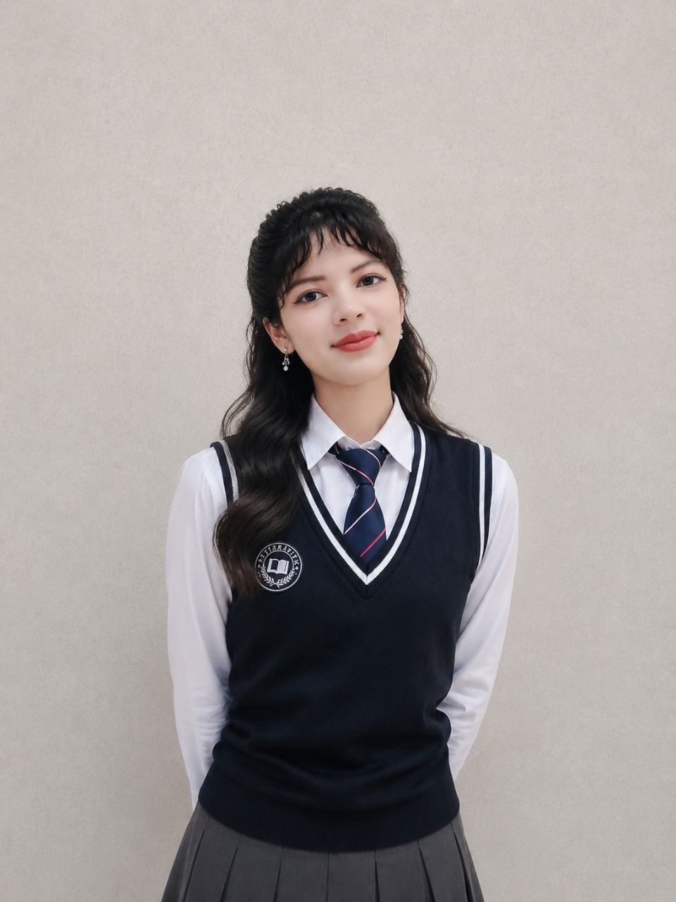
Eshmurzayeva Jasmina Shodiyor qizi was born on November 4, 2009, in the Kashkadarya region of Uzbekistan. She is currently a 10th-grade student at School No. 185 Tashkent. She also holds a CEFR English language certificate.
The sound of the final school bell rang, Touching the deepest strings of my heart. Today, the cheerful melody of childhood Has sworn to make us shed tears.
Look, silence rules the corridors, Every corner is filled with memories. Today, sorrowful tears fill our eyes, As distant horizons call us forward.
The dreams we shared while studying together, The playful mischief we made together… Now all those questions remain unanswered, And those times have turned into longing.
Teacher, I bow before you in respect, I placed your pearls of wisdom in my heart. If my words ever hurt you unknowingly, Please forgive me, for today I cried so much.
Every single letter you taught us Will guide us through the journey of life. You devoted your years for our sake, And now your sons and daughters will miss you.
Looking at our classroom one last time, My heart aches and cries from within. Tears slowly roll down my face, I do not want to leave this beloved home.
Farewell, my dear friend and classmate, I wish to rest my head upon your shoulder and cry. I grew up with you, I matured with you, Today, grief and sadness pierce my heart.
Do not cry, my classmate, do not cry now, No one can escape what fate has written. Our youth has come to an end here, But the memories of school will never die!
Azizaxon Sherzod qizi Shodmonova was born in 2008 in Qarshi district, Kashkadarya region, Uzbekistan. Currently, she has earned the honorable title of a university student ahead of schedule and is studying at the Uzbekistan State World Languages University.
“For years, we’ve been told that positive thinking is the key to a happy, successful life. Not anymore. To hell with positivity!”
— Mark Manson
Everyone goes through adolescence, and right now, I am navigating this exact phase of life. We all know that teenage years come with a wave of hormonal changes, so I won’t dwell too much on that. It is a time when everyone struggles and experiences a certain degree of emotional pain.
As I grew older, my responsibilities multiplied: household chores, studies, language learning, and, most importantly, family issues. This is the period when a person is tested the most, and knowing how to make the right choices becomes vital. However, there was a time when I completely lost interest in everything. I couldn’t focus on my studies, I felt disconnected from the world around me, and I became utterly indifferent to my own future. The underlying reason was simple: I had turned into a “coward.”
Everything began piling up at once. Schoolwork, especially language learning, became incredibly overwhelming because I had reached the most critical and decisive stage — preparing for the “IELTS” exam. Ironically, the very process I had been anticipating so eagerly turned out to be daunting and complex in reality. Unwilling to fight through the difficulties and feeling lost, I chose to escape from my problems… and I began mindlessly scrolling through Reels for temporary hits of dopamine.
No matter how much I tried to force myself to think positively or justify my slacking, the anxiety and inner turmoil kept eating away at me. My peers seemed so much more fortunate and successful than I was. It felt like they could achieve anything, while I, in my own eyes, had become utterly useless. So, what did I do next? I decided that I simply refused to go on living as a useless member of society!
I committed to a radical change. I had always enjoyed reading, but this time, in an effort to understand and discover myself, I turned to self-development literature. I opened the “Mutolaa” app and browsed through the personal growth section. The first book that caught my eye and instantly drew me in was The Subtle Art of Not Giving a Fck*. It perfectly matched my state of mind. As I read, I began questioning the values I had always blindly accepted as true. I threw toxic positivity out the window and learned to embrace “negative thinking” — or rather, looking reality square in the eyes.
Surprised, aren’t you? You read that correctly: I learned to accept the truth for what it is. The more clearly a person can see their own shortcomings, the more they grow, the more real solutions they find to their problems, and the wider their worldview becomes. I put this into practice.
For instance, I was struggling significantly with English Writing (essays). It was a painful sticking point for me. I analyzed the situation brutally, asking myself: “What am I doing wrong? Why does this feel so impossible?” I realized two things. First, my vocabulary was insufficient. Second, even when I did manage to write an essay, I was terrified to re-read it because I was scared of making mistakes. And why was I so afraid of making mistakes? Because I dreaded being criticized by my teacher. But one day, I conquered all my fears and simply read what I had written, then handed it over to my teacher. My teacher simply corrected the errors, and that was it. In that very moment, I realized that you just have to start without fear. I had been making a mountain out of a molehill.
Not everyone can solve their problems independently; many prefer to simply run away from them. I was no exception. I used to try to avoid thinking about even the smallest issues, but deep down, I knew they were draining me every single day. Eventually, I resolved to face them all. Most of my anxieties revolved around my future: “Will I get a high IELTS score? What about the SAT? Will I get accepted into prestigious universities in the US?” These questions spun in my mind like a non-stop carousel.
I tackled these issues by prioritizing the most fundamental ones.
Problem 1 & Solution: Why don’t I always speak fluently and flawlessly in English?
Solution: I realized I had been speaking mechanically. My mindset was basically, “I need to talk, I am talking, so that’s enough.” I wasn’t bringing the same freedom and emotion to English that I naturally use in my native language. The next time I spoke, I infused it with emotion just as I would in my native tongue, and I discovered it became significantly easier.
Problem 2 & Solution: Why did my closest friend betray me?
Solution: In reality, labeling them as my “closest” friend was flawed from the start. A person’s ultimate confidants are only their family and God. My friend hadn’t betrayed me; they had simply made a new friend, built a closer bond with them, and chosen to trust them. They shared their thoughts with them. This is a completely natural human dynamic. Because I had viewed them as my “irreplaceable” friend, I felt like a victim who had been stabbed in the back. The truth is that everyone has the right to choose their friends and confidants, and you cannot force anyone’s affection. Accepting this changed my perspective entirely. The situation wasn’t a tragedy, and I was not a victim.
Conclusion
In conclusion, I realized that during my teenage years, I had been exaggerating minor setbacks and artificially shaping myself into a “victim.” This victim mentality provided a temporary cushion and a false sense of dopamine, making it feel like my problems weren’t my fault. But please, do not make the same mistake!
No matter what challenges you face, whether you are to blame or not, the responsibility and accountability ultimately rest squarely on your shoulders. Always look at situations with a realistic, critical eye and filter your thoughts. Do not run from your problems; solve them. Do not fear losses, and start working for your future today. No one is going to hand you success on a silver platter. You must always strive to reach every single milestone through your own hard work!
Finally, I would like to express my deepest gratitude to Mark Manson, the author of the book that entirely transformed my outlook on life, and I highly recommend that you pick up a copy and read it too.
Giorgio Linguaglossa solleva un interrogativo decisivo sul concetto di arte: «Come e dove orientare la ricerca del nuovo linguaggio poetico?». Dopo la fine dell’evo moderno e di ogni ontologia estetica modernista, decretata da Zygmunt Bauman e dalla new sociology contemporanea, ogni meta-filosofo post-modernista – come Jencks con l’architettura, Danto con l’arte o Fukuyama con la storia- ha la tentazione di irrogare la sanzione definitiva di condanna a morte dell’oggetto della sua filosofia, senza fare i conti teoretici con la lezione contenuta in La condition postmoderne e nel bellissimo misconosciuto Le postmoderne expliqué aux enfants di Jean-François Lyotard: il nucleo del post-modernismo consiste nell’ammissione della caduta di ogni «métarécits», cioè della delegittimazione delle metanarrazioni della modernità e della concezione e di «univers(o)alità». L’iper-modernismo, conscio della distinzione lyotardiana tra morte del discorso e morte del meta-discorso, resuscita l’arte e seppellisce l’everything goes di Danto: contro il post-modernismo si innalza l’iper-modernismo di Virilio, Baudrillard e Lipovetsky; contro il post-moderno si innalza l’iper-moderno di Bauman (liquid society) e Beck (risk society) [la post-modernità ha sempre mantenuto una certa vagueness confusionaria tra teoria (post-modernismo) o spazio storico (post-moderno)]. L’iper-modernismo, come ogni neo-avanguardia millenials (esempio italiano il mio neoN-avanguardismo), abbandona – come consolidato- il dibattito sull’anti-«univers(o)alismo» e si inserisce in continuità antagonistica con il modernismo, a differenza del post-modernismo, liberando i suoi missili Katjuša in direzione della delegittimazione di ogni forma di «canone» e «Tradizione», schiavo della sua vena neo-avanguardistica. Però, l’iper-modernismo, è un movimento della krisis. Chiusa la krisis, ogni avanguardia/neo-avanguardia, auto-criticandosi, si suicida artisticamente, e, finalmente entra in campo il tardomodernismo. Cos’è il tardomodernismo? Prima di tutto è, insieme, teoria e spazio storico: supera a sinistra post-modernismo e iper-modernismo dichiarando la fine definitiva dell’ontologia e il distacco totale dal modernismo, naturale o caricaturale; supera a destra post-modernità e iper-modernità, ufficializzando il trapasso dall’evo moderno all’evo tardomoderno (come ripetizione storica del trapasso tra evo antico ed evo tardoantico).
L’affermazione di Giorgio Linguaglossa è falsa: «La risposta che al momento possiamo dare è che oggi, nel 2025, non si può porre mano ad alcuna ermeneutica dell’arte a seguito della Fine della poiesis, di quella che un tempo si chiamava «arte» nel tempo della storia progressiva; oggi, nel tempo della storialità (cioè della storia non-progressiva), la fine dell’«arte» trascina con sé anche la fine della critica d’arte. E qui il discorso si chiude». Giorgio ricade nel post-modernismo di Jameson (1) e Danto, formalizzando, inavvertitamente, un’utopia della distopia, con una kitchen dystopian utopia. L’arte non è morta: è morta ogni meta-narrazione universale sull’arte, cioè ogni ermeneutica (critica) letteraria fondata sull’auto-dichiarazione d’essere un’interpretazione oggettiva dell’arte. L’artista, riunito in bund, kolektivne, assemblee aeriformi, nomadi e resilienti, metabolizzato l’errore della storiografia filosofica moderna sulla distinzione aristotelica tra ποίησις e πρᾶξις, rifiuta la nozione stessa di «poesia» o anti-«poesia» come creazione fantastica di un oggetto-linguaggio e, nel nome di una concezione pragmatics dell’oggetto-linguaggio medesimo, rilancia l’interpretazione autentica dell’artista contro ogni interpretazione soggettiva del critico letterario. La critica non è morta: è diventata interpretazione debole soggetta alla meta-critica argomentativa (Habermas) dell’artista. L’artista diventa agens (engaged poetry), da faber, organizza l’oggetto-linguaggio secondo i suoi fini, sostituisce l’ermeneutica con la praxeologia, si appropria del fare arte (discorso), del dire arte (meta-discorso) e del contra-dire arte (mega-meta-discorso), acquisendo il ruolo di artista, critico e meta-critico (contro-recensioni termonucleari), contro ogni tentativo di veramusement kitchen dell’arte e contro ogni ontologia del modernismo lirico/elegiaco. Dallo scivolamento, alla trasformazione, finalmente all’opposizione aperta (riots). La kitchen poetry, ferma a Danto, ostinata nel tentare una rifondazione ontologica di un veramusement della ποίησις uscita dal nucleo dell’arte, resta nella fase dello scivolamento tra modernismo e post-modernismo, non riuscendo, ancora, ad entrare nel tardomoderno. Il tardomodernismo è una praxis distopica che annichilisce ogni forma di ontologia e di fenomenologia dell’arte, sostituendo ontologia estetica e fenomenologia estetica con una socio/etno/antropologia (anestetica) estetica, KNSEAE, basata sull’«inter-azione» sociale (disconoscimento della decadimento della triade mittente/messaggio/destinatario). La riot poetry tardomodernista non «[…] prende un frammento (in chiaro) e lo getta sulla parete bianca della tela del nulla […]»: organizza un frammento (in clearity) e – come un ariete- lo sbatte sulle mura bianche della tela dello Stato Pontificio. Papa re mondadoriano, you’re under attack!
Il Kolektivne NSEA, riunito in Prezidium, analizza e interpreta il concetto di risonanza distopica, utilizzata dalle correnti kitchen, riot e frammentiste dell’opposizione allo Stato Pontificio lirico/elegiaco. Perchè una risonanza distopica deve necessariamente implicare una risonanza caotica (Morin e Maturana), senza affrontare la Rehabilitierung del pragmatismo contemporaneo (Rorty e Putnam), e non tradursi in risonanza magnetica? Precisiamo: diventa necessario, in letteratura, con una attenta serie di definizioni e ri-definizioni, non confondere la risonanza distopica (effetto) con la risonanza caotica (strategia): la risonanza distopica è l’effetto di un senso distopico che una strategia di risonanza cagioni sul lettore. La risonanza caotica, con i suoi trojan, con la sua volontaria alternanza tra emetico ed ermetico, sibilino e acufenico, corre il rischio di attivare, nel lettore (fake), una sensazione di spaesamento (risonanza distop-utopica). La risonanza magnetica, catalizzando l’attenzione del lettore (fake), con una serie di atti, praxeologici, di dédoublement, di carnevalizzazione, di остранение, di anti-frasticità ironica, crea un campo di «interazione sociale» idoneo a costruire una relazione tra artista e lettore (fake), λόγος, orientata al racconto, con massima clearity eosservazione indiretta (partecipante), sulla verità della situazione sociale attuale, intrinsecamente distopica. La realtà è distopica: diviene necessario introdurre una praxia (la ποίησις, nel tardomoderno, si è fatta πρᾶξις) neutra – come Gedankenexperiment– in grado, attraverso una strategia di risonanza magnetica, di maltrattare e terrorizzare il lettore (fake), in modo da influenzare il perseguimento di un futuro a-distopico. L’uso di una strategia di risonanza, caotica o magnetica, crea un λόγος, di spaesamento o di terrorismo, tra un artista e un lettore (fake): cade il fondamento teoretico neo-ontologico del rifiuto della triade mittente-messaggio-destinatario. L’utilizzare un effetto risonanza, implicando una sottostante «interazione sociale», conduce all’antinomia coll’affermazione del rifiuto della triade mittente-messaggio-destinatario. Qualsiasi effetto/strategia risonanza necessita di un mittente, l’artista, di un destinatario, il lettore (fake) e di un messaggio (spaesamento o terrorismo). Il tardomodernismo risolve l’antinomia teoretica di ogni nuova ontologia estetica ri-definendo la triade mittente-messaggio-destinatario, in doppio senso (Il contributo «neon»-avanguardista alla concretizzazione di un’originale anti-«forma-poesia»), utilizzando una strategia di risonanza magnetica terroristica e rifiutando ogni forma di «poesia», e di «poesia» distopica, sostituendola con «esperimenti» praxeologici atopici. Il tardomodernismo è atopico.
The late-modernism
Giorgio Linguaglossa raises a crucial question about the concept of art: «How and where to orient the search for the new poetic language?». After the end of the modern era and of every modernist aesthetic ontology, decreed by Zygmunt Bauman and contemporary new sociology, every post-modernist meta-philosopher – like Jencks with architecture, Danto with art or Fukuyama with history – is tempted to impose the definitive sanction of death sentence on the object of his philosophy, without taking into theoretical consideration the lesson contained in La condition postmoderne and in the beautiful and unknown Le postmoderne expliqué aux enfants by Jean-François Lyotard: the core of post-modernism consists in the admission of the fall of every «métarécits», that is, the delegitimization of the metanarratives of modernity and of the conception and of «univers(o)ality». Hyper-modernism, aware of Lyotard’s distinction between the death of discourse and the death of meta-discourse, resuscitates art and buries Danto’s everything goes: against post-modernism rises the hyper-modernism of Virilio, Baudrillard and Lipovetsky; against post-modern rises the hyper-modern of Bauman (liquid society) and Beck (risk society) [post-modernity has always maintained a certain confusing vagueness between theory (post-modernism) or historical space (post-modern)]. Hyper-modernism, like every neo-avant-garde millennials (an Italian example is my neoN-avant-garde), abandons – as consolidated – the debate on anti-«univers(o)alism» and inserts itself in antagonistic continuity with modernism, unlike post-modernism, unleashing its Katjuša missiles in the direction of delegitimizing every form of «canon» and «Tradition», a slave to its neo-avant-garde vein. However, hyper-modernism is a movement of the krisis. Once the krisis is over, every avant-garde/neo-avant-garde, self-criticizing, commits artistic suicide, and, finally, late-modernism enters the field. What is late-modernism? First of all, it is, at the same time, theory and historical space: it surpasses post-modernism and hyper-modernism on the left by declaring the definitive end of ontology and the total detachment from modernism, natural or caricatural; it goes beyond post-modernity and hyper-modernity on the right, making official the transition from the modern era to the late modern era (as a historical repetition of the transition between the ancient era and the late ancient era).
The late-modernist artist
Giorgio Linguaglossa’s statement is false: «The answer we can give at the moment is that today, in 2025, we cannot undertake any hermeneutics of art following the End of poiesis, of what was once called «art» in the time of progressive history; today, in the time of historiality (that is, of non-progressive history), the end of «art» also brings with it the end of art criticism. And here the matter ends». Giorgio falls back into the post-modernism of Jameson (1) and Danto, inadvertently formalizing a utopia of dystopia, with a kitchen dystopian utopia. Art is not dead: every universal meta-narration on art is dead, that is, every literary hermeneutic (criticism) founded on the self-declaration of being an objective interpretation of art. The artist, gathered in bunds, kolektivne, aeriform, nomadic and resilient assemblies, having metabolised the error of modern philosophical historiography on the Aristotelian distinction between ποίησις and πρᾶξις, rejects the very notion of «poetry» or anti-«poetry» as a fantastic creation of a language-object and, in the name of a pragmatics conception of the language-object itself, relaunches the authentic interpretation of the artist against any subjective interpretation of the literary critic. Criticism is not dead: it has become a weak interpretation subject to the argumentative meta-criticism (Habermas) of the artist. The artist becomes agens (engaged poetry), from faber, organizes the language-object according to his ends, replaces hermeneutics with praxeology, appropriates the making of art (discourse), the saying of art (meta-discourse) and the counter-saying of art (mega-meta-discourse), acquiring the role of artist, critic and meta-critic (thermonuclear counter-reviews), against every attempt at a veramusement kitchen of art and against every ontology of lyrical/elegiac modernism. From the slide, to the transformation, finally to the open opposition (riots). Kitchen poetry, stuck in Danto, obstinate in attempting an ontological refoundation of a veramusement of the ποίησις that has emerged from the nucleus of art, remains in the phase of the slide between modernism and post-modernism, still unable to enter the late modern. Late-modernism is a dystopian praxis that annihilates every form of ontology and phenomenology of art, replacing aesthetic ontology and aesthetic phenomenology with an aesthetic socio/ethno/anthropology (anesthetic), KNSEAE, based on social «inter-action» (disavowal of the decay of the sender/message/recipient triad). Late modernist riot poetry does not «[…] take a fragment (in clearity) and throw it on the white wall of the canvas of nothingness […]»: it organizes a fragment (in clearity) and – like a battering ram – slams it on the white walls of the canvas of the Papal State. Mondadori Pope King, you’re under attack!
Chaotic resonance or magnetic resonance? Late modernism is atopic
The Kolektivne NSEA, gathered in Prezidium, analyzes and interprets the concept of dystopian resonance, used by the kitchen, riot and fragmentist currents of the opposition to the lyrical/elegiac Papal State. Why must a dystopian resonance necessarily imply a chaotic resonance (Morin and Maturana), without addressing the Rehabilitierung of contemporary pragmatism (Rorty and Putnam), and not translate into magnetic resonance? Let us clarify: it becomes necessary, in literature, with a careful series of definitions and re-definitions, not to confuse dystopian resonance (effect) with chaotic resonance (strategy): dystopian resonance is the effect of a dystopian sense that a resonance strategy causes on the reader. The chaotic resonance, with its trojan, with its voluntary alternation between emetic and hermetic, sibilant and tinnitus, runs the risk of activating, in the (fake) reader, a feeling of disorientation (dystop-utopian resonance). The magnetic resonance, catalyzing the attention of the (fake) reader, with a series of acts, praxeological, of dédoublement, of carnivalization, of остранение, of ironic anti-phrasticity, creates a field of «social interaction» suitable for building a relationship between artist and (fake) reader, λόγος, oriented towards the story, with maximum clarity and indirect (participant) observation, on the truth of the current social situation, intrinsically dystopian. Reality is dystopian: it becomes necessary to introduce a neutral praxia (ποίησις, in late modernity, has become πρᾶξις) – as Gedankenexperiment – capable, through a strategy of magnetic resonance, of mistreating and terrorizing the reader (fake), so as to influence the pursuit of an a-dystopian future. The use of a strategy of resonance, chaotic or magnetic, creates a λόγος, of disorientation or terrorism, between an artist and a reader (fake): the neo-ontological theoretical foundation of the refusal of the sender-message-recipient triad falls. The use of a resonance effect, implying an underlying «social interaction», leads to the antinomy with the affirmation of the refusal of the sender-message-recipient triad. Any effect/resonance strategy needs a sender, the artist, a recipient, the reader (fake) and a message (disorientation or terrorism). Late modernism resolves the theoretical antinomy of every new aesthetic ontology by redefining the triad sender-message-recipient, in a double sense (The «neon»-avant-garde contribution to the concretization of an original anti-«form-poetry»), using a strategy of terrorist magnetic resonance and rejecting every form of «poetry», and dystopian «poetry», replacing it with atopic praxeological «experiments». Late modernism is atopic.
I tried to press ‘Normal’ to the mode of the conversations I had with my parents,
I wanted everything to become normal again,
I wanted to start laughing again with them,
I wanted the joy of the child to come back again,
But none of the things I did worked out.
I tried many times
Just to have my heart shattered again.
Mom was easier to manage
But Dad was the most difficult
Always bringing up the past
Always sounding so hostile
And my fragile spirit suffered.
It happened for a long period of time,
Me trying to become a good child
And them being too difficult to placate.
Then I decided to stop.
I decided to stop trying so hard to please
I decided to bar my soul from being wounded
I decided to start carving out joy for myself
I decided to look for love elsewhere
I decided to love myself,
Because for many years I had seen myself through the distorted views of my parents.
I had seen myself as someone who could never do the right things.
I had seen myself as someone who would be very unlikable.
I had seen myself as one who was very inferior.
I had seen myself as someone who was below the expectations they had for me,
So, on a good day, I decided to make peace with myself.
How did I do it?
I stopped to care about what anyone thought about me.
I stopped to crave for their love.
I distanced myself from people
I no longer jumped into conversations
I no longer laughed so hard.
I shielded my soul.
I became a bit rested,
Because I was no longer having arguments with my parents every now and then,
Arguments that left me shattered and broken.
I was no longer having the exchange of bitter words.
I no longer allowed anybody’s bitter words to penetrate me.
But very soon,
My mom discovered how quiet I had become,
How taciturn,
How separated,
So she started sermons about the broom that is stronger when it’s in the bunch
But becomes weak when it’s separated from the rest of the broomsticks.
I didn’t care.
Later her sermon changed to love.
‘If you don’t have love for your fellow human being, everything you are doing is a waste of time.’
I didn’t care.
Then one day she stopped being indirect and came directly to pose her question.
‘Why do you now keep quiet at me?
Why do hesitate before answering my questions?’
Silence.
I didn’t give an answer.
I just stared until she left the room.
What answer should I give?
They are the reason why I had become so quiet.
Isaac Dominion Aju is a Nigerian writer who has been nominated for the Pushcart Prize and Best Of The Net Awards. He’s appeared on international journals, including Poetry X Hunger, Kalahari Review, and Steel Jackdaw Magazine.
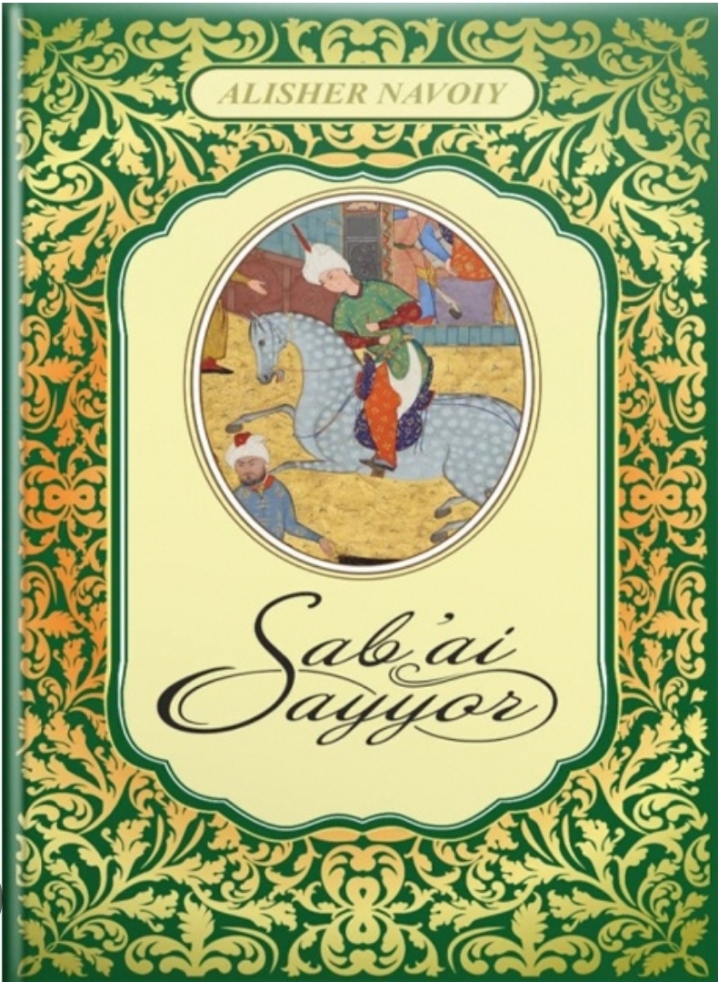
DIDACTIC ANALYSIS OF THE STORIES IN ALISHER NAVOI’S SAB’AI SAYYOR
Introduction
One of the greatest representatives of Uzbek classical literature, Alisher Navoiy, occupies a unique place in the spiritual and cultural life of the Uzbek people. His literary masterpiece, the Khamsa (Quintet), is considered one of the most valuable treasures of Eastern literature. Each poem within this cycle possesses not only high artistic merit but also profound educational and moral significance. Sab’ai Sayyor is the fourth poem of the Khamsa, in which the adventures of Bahram and Dilorom are used to explore themes such as human morality, spiritual perfection, justice, love, knowledge, loyalty, and ethical development.
A distinctive feature of the poem is the inclusion of seven stories narrated by seven princesses from different regions of the world. These stories enrich the ideological and artistic content of the work and serve as an important means of expressing Navoi’s didactic views. Through these narratives, the poet presents significant conclusions about human virtues, spiritual values, and social responsibilities. Therefore, the stories in Sab’ai Sayyor can be regarded not only as artistic elements of the poem but also as a unique school of moral and educational instruction.
This article analyzes the didactic essence of the stories in Sab’ai Sayyor, their educational orientation, and their role in cultivating the ideal human being.
Main Body
The Role of the Stories in the Composition of the Poem
Sab’ai Sayyor possesses a complex compositional structure. While the central plot revolves around the life of Bahram and his adventures related to Dilorom, the stories told in the seven pavilions enrich the ideological framework of the poem. Each story conveys a particular moral and philosophical idea and contributes to Bahram’s spiritual growth.
Navoi does not present these stories as isolated events; rather, they function as essential components of the poem’s overall ideological system. Through them, he depicts various challenges encountered in human life, the struggle between good and evil, and the power of love and loyalty. As a result, readers not only enjoy the artistic narrative but also derive valuable moral lessons from it.
The Didactic Interpretation of Justice
One of the most important didactic aspects of the stories is the glorification of justice. Navoi presents justice as the fundamental principle of both governance and human relationships. In the stories, virtuous and just individuals ultimately achieve success and happiness, while those who choose oppression, deceit, or betrayal face punishment.
Through these examples, the poet emphasizes that justice is an essential requirement of life. The destinies of the characters demonstrate that people should remain faithful to truth and fairness under all circumstances. This significantly enhances the educational value of the stories.
The Moral Significance of Love and Loyalty
Love is a central theme in many of the stories found in Sab’ai Sayyor. However, Navoi does not portray love merely as an emotional experience. Instead, he presents it as a force that purifies the human soul and guides individuals toward spiritual perfection.
The lovers in these stories undergo numerous trials and hardships. Their patience, devotion, and perseverance serve as exemplary models for readers. Overcoming obstacles in the path of love reveals inner strength and moral maturity. Through these narratives, Navoi demonstrates that true love is based on loyalty, patience, and self-sacrifice.
From a didactic perspective, these stories encourage young readers to remain faithful in relationships, to act sincerely, and to pursue their goals with determination.
The Glorification of Knowledge and Wisdom
The promotion of knowledge and enlightenment is one of the fundamental principles of Navoi’s literary and philosophical outlook. In the stories of Sab’ai Sayyor, intelligence and wisdom are portrayed as humanity’s greatest treasures. The success of many characters is directly connected to their knowledge, insight, and sound judgment.
Navoi condemns ignorance as a major obstacle to human progress. Characters who rely on reason and wisdom successfully overcome difficult situations, whereas those who act impulsively often encounter regret and failure.
This aspect enhances the didactic value of the stories and encourages readers to seek education, develop critical thinking skills, and approach life’s challenges rationally.
Moral Perfection and Human Education
The primary objective of the stories is the cultivation of the ideal human being. According to Navoi, a perfect person should not only be knowledgeable but also morally pure, just, generous, and compassionate. Throughout the stories, positive virtues and negative traits are contrasted with one another.
Generosity is opposed to greed, loyalty to betrayal, and honesty to falsehood. Ultimately, goodness triumphs over evil, allowing readers to distinguish clearly between desirable and undesirable forms of behavior.
Through these narratives, Navoi emphasizes the importance of self-discipline, striving for noble goals, and placing the interests of society above personal gain. These ideas remain relevant in contemporary society.
Symbolism and Its Didactic Function
The stories in Sab’ai Sayyor are rich in symbolic and allegorical imagery. Navoi frequently employs symbolic representation rather than direct expression, encouraging readers to engage in deeper reflection and interpretation. Symbolism enhances not only the artistic quality of the narratives but also their educational impact.
Motifs such as journeys, roads, trials, lovers, and beloveds symbolize humanity’s quest for spiritual growth and self-realization. These symbols deepen the philosophical meaning of the stories and strengthen their didactic message.
Conclusion
In conclusion, the stories contained in Sab’ai Sayyor embody Alisher Navoi’s profound didactic and philosophical ideas. Through these narratives, universal values such as justice, knowledge, love, loyalty, generosity, and moral perfection are promoted. The stories not only enrich the plot of the poem but also contribute significantly to the moral and spiritual education of readers.
Navoi employs storytelling as a powerful tool for shaping human character and presenting his ideal of the perfect individual. Each story conveys a distinct ethical lesson, guiding readers toward virtue, purity, and enlightenment. Therefore, the stories of Sab’ai Sayyor remain an important source of moral and spiritual wisdom not only for their own era but also for modern society. Their didactic significance makes them valuable resources for educating younger generations in the spirit of both national and universal values.
About the Author
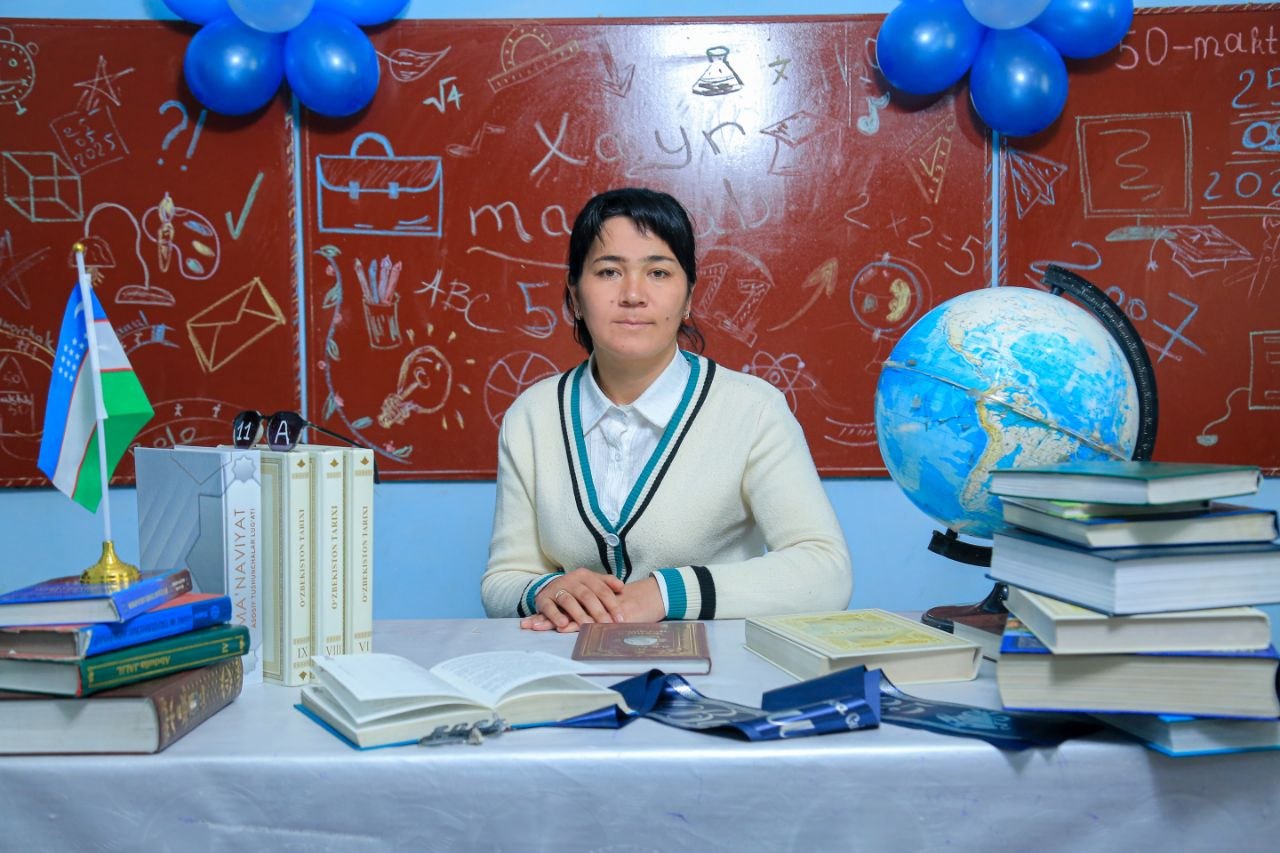
Ahmedova Zamira Shokirjon qizi was born on July 12, 1991, in Varzik village, Chust district, Namangan region, Uzbekistan. She completed her secondary education at School No. 58 in her native village and later graduated from the Faculty of Philology at the Tashkent State Pedagogical Institute. Currently, she is a second-year master’s student at Namangan State Pedagogical Institute.
From an early age, Zamira demonstrated a strong interest in language and literature. Her stories and literary works on various topics have been regularly published in district and national media outlets, reflecting her creative talent and dedication to literature. Through her academic and creative activities, she continues to contribute to the promotion of literary and cultural values.
Zamira’s primary goal is to become a highly qualified specialist in the field of philology and to share her knowledge and experience with the younger generation, inspiring them to appreciate language, literature, and lifelong learning.
A child’s imagination is one of the most beautiful and powerful gifts in life. It is through imagination that children learn to dream, explore, and believe in possibilities far beyond what their eyes can see. Among the many things that help a child grow, reading stands as one of the greatest treasures. A simple book, filled with words and stories, has the magical ability to open doors to worlds children never knew existed. Reading does not only teach children letters and words; it teaches them how to imagine, feel, dream, and understand life in a deeper way. When a child opens a book, something truly special begins to happen. They are no longer sitting quietly in one room; instead, they travel to magical kingdoms, fly through the sky with heroes, dive into deep oceans, or walk through forests filled with wonder. A story becomes more than just words on paper—it becomes an experience. A child who reads about brave explorers may begin dreaming about adventures of their own, while a child who reads stories about kindness may grow into a more caring and understanding person. Unlike television or smartphones, reading requires children to build the story inside their own minds. When a book describes a castle, a dragon, or a peaceful village, every child imagines it differently. One child may picture a shining golden castle in the clouds, while another imagines a mysterious stone palace hidden in the mountains. This beautiful process strengthens creativity because children become creators of their own worlds. Their minds begin to think freely, shaping colors, faces, emotions, and places in ways no screen could ever fully provide.
Reading also helps children understand feelings—both their own and those of others. Through stories, children experience joy, sadness, fear, hope, friendship, and courage. They laugh with happy characters and feel pain when a character struggles. Sometimes, a child may quietly see themselves in a story, finding comfort in knowing they are not alone in their feelings. In this way, books become silent friends, offering lessons, warmth, and understanding without judgment. Imagine a child sitting by a window on a rainy evening, holding a favorite book in their hands. Outside, the world may seem ordinary, but inside their imagination, extraordinary things are happening. They are climbing mountains, speaking with magical creatures, or solving mysteries with brave companions. That child may not realize it at the moment, but they are learning valuable skills—creativity, patience, empathy, and confidence. Reading shapes not only the imagination but also the heart.
Furthermore, reading gives children the courage to dream bigger. A child who reads stories about inventors may dream of changing the world someday. A child inspired by stories of brave leaders may grow up believing they, too, can make a difference. Books quietly plant seeds of hope and ambition in young hearts. Even the smallest story can leave a lifelong impact.
In today’s fast-moving world, many children spend more time watching screens than opening books. Phones, games, and videos can entertain them quickly, but entertainment is not always the same as imagination. Screens often show children exactly what to think and what to see, while books invite them to think for themselves. Reading teaches patience in a world of speed and creativity in a world filled with distractions. Parents and teachers play an important role in helping children fall in love with reading. Reading bedtime stories, visiting libraries, or simply allowing children to choose books they enjoy can create beautiful memories. Sometimes, the moments children remember most are not expensive gifts or big adventures, but quiet evenings spent listening to stories with someone they love. Those moments can shape a child’s future in powerful ways. A child who reads often grows into a person who thinks deeply, dreams freely, and understands others kindly. Imagination developed through reading can help children become better writers, artists, scientists, teachers, or leaders. More importantly, it helps them become compassionate human beings who believe that anything is possible.
In conclusion, reading is much more than a school activity or daily habit—it is a journey of the heart and mind. It teaches children to imagine worlds they have never seen, understand feelings they have never experienced, and believe in dreams they have not yet reached. Every book a child opens becomes a small light guiding them toward creativity, wisdom, and hope. If we want children to grow into thoughtful, imaginative, and confident individuals, we must place books in their hands and stories in their hearts. Because sometimes, the greatest magic a child will ever discover begins with turning the first page of a book.